Obersalzberg - Jennerbahn mid-station - Königssee parking lot

Berchtesgaden High-Altitude Trail: Stage 1
  • Mountain Hike
  • Mountaineering
  • 8:00 h
  • 16,4 km
  • 928 hm

A hike through history: Obersalzberg, Carl-von-Linde-Weg, Jennerbahn mid-station, Königsbachalm, Jennerbahn valley station

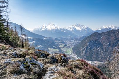
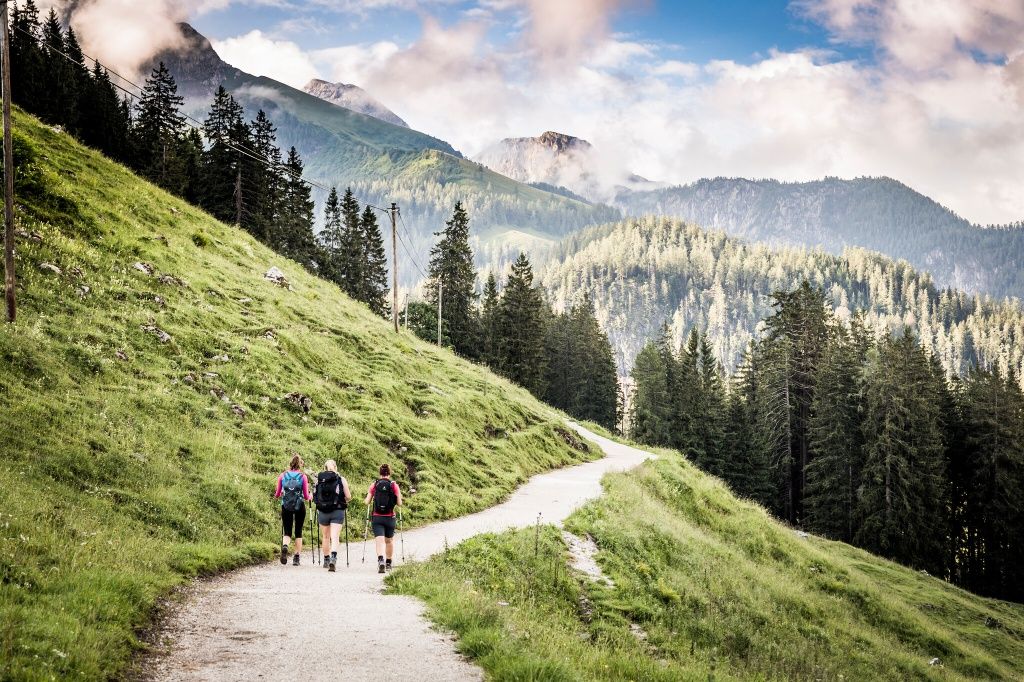
From the Obersalzbergbahn valley station, take the red gondolas up to Obersalzberg. Once at the top, follow the Carl-von-Linde-Weg. After passing through a short tunnel, continue toward Hinterbrand and Vorderbrand. At Gasthof Vorderbrand, climb up to Brandkopf. From there, enjoy magnificent views of Schönau and Watzmann.

Continue downhill before climbing again to the Jennerbahn mid-station. Follow the Königsweg to Königsbachalm, where you can stop for food and drinks. Then descend via the Hochbahnweg to the Jennerbahn valley station. From there, Lake Königssee is just a short walk away. At the parking lot, you’ll find the Tourist Information Office and a bus stop.
Route details

  • Difficulty
    intermediate
  • Start point

    Berchtesgaden Hauptbahnhof (central station)

  • Destination

    Königssee bus stop

    Duration8:00 h
    Distance16,4 km
    Ascent928 hm
    Descent868 hm

    Fitness level4/6
    Difficulty2/6
    Landscape6/6
    Experience6/6

J F M A M J J A S O N D

The trail from Königsbachalm down to Lake Königssee is also a popular route for mountain bikers.

Directions

This stage starts at Berchtesgaden train station. With the station behind you, keep left at the roundabout and turn left after Hotel Schwabenwirt. Follow the Königsseer Ache toward Berchtesgaden Salt Mine until you reach the Obersalzbergbahn valley station. Take the cable car up to the mountain station. From there, follow the signs for the Carl-von-Linde-Weg toward Hochlenzer. Stay on the Carl-von-Linde-Weg, pass through a short tunnel, and then follow the trail signs toward Hinterbrand and Vorderbrand.

At Gasthof Vorderbrand, keep left and take the trail on your right up to Brandkopf. From the summit, enjoy magnificent views of Schönau, Watzmann, and Grünstein. Descend the other side on a narrow mountain trail, follow the road for a short distance, and then climb to the Jennerbahn mid-station. From there, follow the hiking signs along the Königsweg to Königsbachalm. This is your last chance to stop for a break before descending on the forest road via Hochbahn to the Jennerbahn valley station and Lake Königssee. Pass the valley station, cross the parking lot, and continue to the bus stop by the Tourist Information Office. This is where Stage 1 ends.

  • Sepp Wurm

    Königssee - Kühroint - Falzsteig - Wimbachbrücke

    • 8:00 h
    • 16,8 km
    • 1153 hm
    • Mountain Hike
    • Mountaineering
  • Tourenportal Berchtesgadener Land

    Wimbachbrücke - Schattseitweg - Hintersee

    • 7:00 h
    • 14,6 km
    • 927 hm
    • Mountain Hike
    • Mountaineering
  • Sepp Wurm

    Hintersee - Mordaualm - Bischofswiesen

    • 8:00 h
    • 19,0 km
    • 841 hm
    • Mountain Hike
    • Mountaineering
  • Thomas Kujat

    Bischofswiesen - Scheibenkaser - Kugelmühle

    • 8:50 h
    • 17,0 km
    • 1033 hm
    • Mountain Hike
    • Mountaineering
  • View from the Lärchecker Wand across the Berchtesgaden Valley
    Bergerlebnis Berchtesgaden

    Scheffau - Lärcheckwand - Obersalzberg Documentation Center

    • 7:05 h
    • 15,2 km
    • 966 hm
    • Mountain Hike
    • Mountaineering